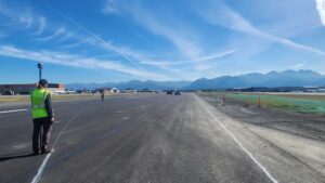
Huffman Business Park ALTA Survey

Location: Anchorage, Alaska

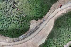
In 2025 a private client contracted BELL to conduct an ALTA survey of a 2-acre property in the Anchorage business park. BELL researched and analyzed title and easement documents, conducted boundary retracement, field survey, and prepared a survey to ALTA/NSPS Land Title Survey standards. To meet the client’s accelerated delivery request, BELL integrated conventional surveying, terrestrial laser scanning, and drone aerial imagery resulting in an efficient and comprehensive dataset that reduce the field time needed to complete the survey.

Kenai Spurr Offshore Platform

Location: Kenai, Alaska

In 2025 BELL was commissioned to scan the exterior, landings, catwalks, stairways, and wellhouse rooms of an existing offshore platform. The focus of the project was to gather as much information on visible pipes, supports, structural components, stairways, and catwalks to assist in civil engineering designs. Bell used the Faro S150 scanner to furnish 3D scan data, as well as 360-degree panoramic images. Since this site was not easily accessible, the large data set efficiently provided by the scanner, was ideal.

Merrill Field Construction Survey

Location: Anchorage, Alaska

In 2025 BELL assisted in the upgrade and repaving at the Merrill Field runway. Work consists of topography for final volume computations, runway striping, staking light cans, and setting primary monuments. BELL was able to efficiently perform this work, while still abide by the tight airport tolerances.

Willow Pipeline Project

Location: North Slope, Alaska

2023-2025 BELL offered survey support on a pipeline expansion project on the North Slope. This multi-year project was over 25 miles of pipeline (over 2600 piles) ranging from the Willow project to Prudhoe Bay lease. Survey services include establishing and expanding survey control networks, precise pile staking, pipeline layout, tie-in support, and post-construction as-builts. A key differentiator in the success of this project was our ability to conduct stake-out computations in real-time, enabling immediate field adjustments and ensuring alignment with project tolerances. BELL’s field teams maintained close coordination with multiple contractors, facilitating seamless communication and schedule adherence.

NANA Reservoir Platting

Location: Deadhorse, Alaska

BELL provided professional land surveying services to conduct the platting of ASLS 2016-25 to facilitate the issuance of a lease to the North Slope Borough. The project included the surveying and platting of a 62-acre reservoir located west of the Sagavanirktok River. Tasks included research, recovering and setting monumentation, and preparing and record a plat in accordance with the DNR and NSB regulations. Additionally, BELL had to establish the boundary between the Sagavanirktok River and ASLS 2016-25 by determining the original (naturally unaltered) ordinary high-water line.

Trail Mapping DNR Record of Survey

Location: Valdez, Alaska

The purpose of this survey was to create a Record of Survey (ROS) to the Department of Natural Resources standards in order to support new land management for the city. The survey included establishing control and locating 3 miles of trail and associated improvements. BELL was tasked with recovering as much of the original monumentation as possible, some dating back to the early 1900s. It was exciting to recover some of the original stone tablets used for survey monuments.

Manh Choh Gold Mine

Location: Tok, Alaska

In 2023–2024 BELL provided surveying and engineering support for the construction of an 11‑mile mine access road and mining infrastructure. Tasks performed were topographic survey, contour slope and clearing limit staking, material volumes, improvement staking, and drone imagery.